|
|
|
COURSE AND VENUE MAPS
|
Home
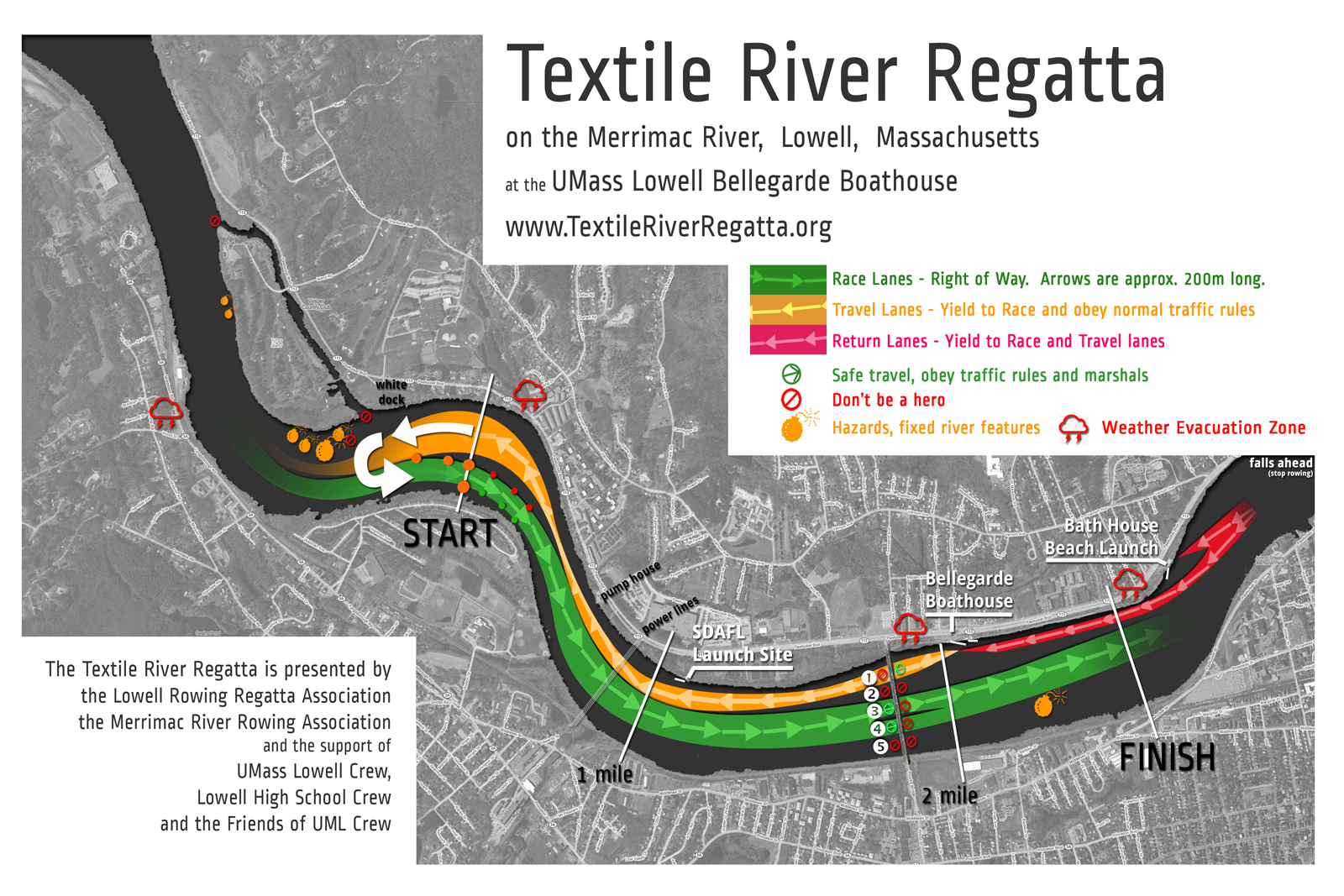
The nominal course length for official purposes is 4500m.
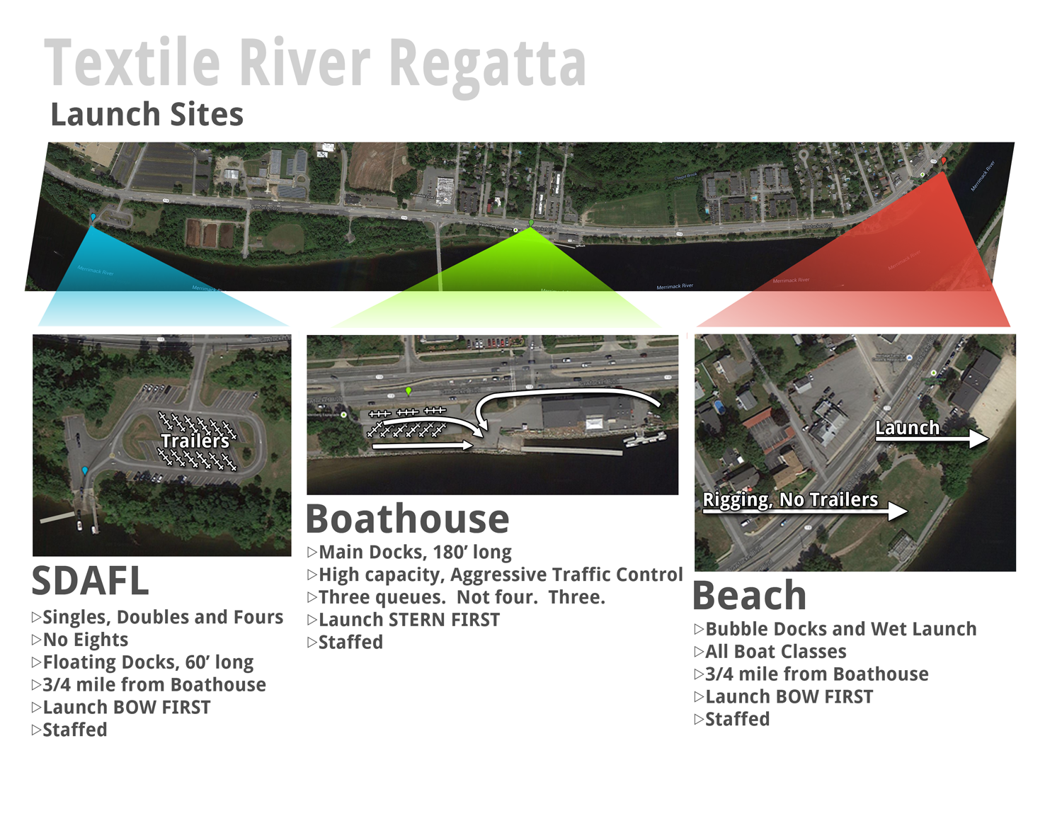
Launch Sites
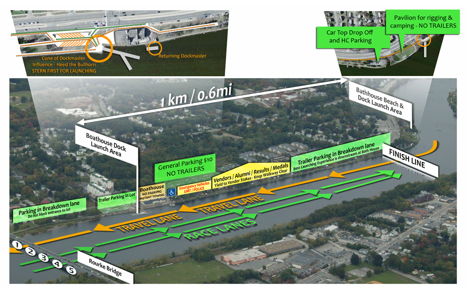
SDAFL is Open for Business in 2016
The SDAFL site shown on the map below is offically renamed "Rourke Ramp".
- Car Top Lot, and small trailers welcome. Detatch your cab and you MUST REGISTER AND HAVE PARKING PASS FOR TRAILERS AT THIS LOCATION. Car top people do NOT need a parking pass. Car top parking is not allowed at the boathouse or beach, but you can drop off your boat at those locations, then park your car.
- Extra Parking across the street from Rourke Ramp for cars after dropping off shells, and a few emptied trailers. There is a pedestrian shuttle stop at this location that will allow people to get to the Boathouse, vendor, and medals area.
Printable PDF (8x11)
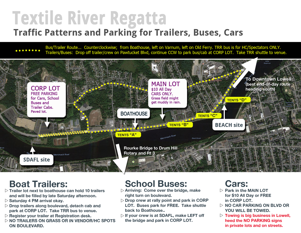
Land Traffic Patterns
There is a shuttle stop close to the Rourke Ramp (SDAFL) site. There's also a continuous asphalt path on
the river side of the boulevard that connects SDAFL to the Boathouse and all the way down to the
Finish and Beach area if you prefer to walk or bike.
Printable PDF (8x11)
|
|
|
Textile River Regatta Committee
P.O. Box 1493
Lowell, MA 01852-1493
info@textileriverregatta.org
©2026 The Textile River Regatta. All Rights Reserved.
|
|
|
|